Checking for non-preferred file/folder path names (may take a long time depending on the number of files/folders) ...
This resource contains some files/folders that have non-preferred characters in their name. Show non-conforming files/folders.
This resource contains content types with files that need to be updated to match with metadata changes. Show content type files that need updating.
| Authors: |
|
|
|---|---|---|
| Owners: |
|
This resource does not have an owner who is an active HydroShare user. Contact CUAHSI (help@cuahsi.org) for information on this resource. |
| Type: | Resource | |
| Storage: | The size of this resource is 56.8 MB | |
| Created: | Jan 23, 2020 at 10:38 p.m. (UTC) | |
| Last updated: | Jan 23, 2020 at 10:45 p.m. (UTC) (Metadata update) | |
| Published date: | Jan 23, 2020 at 10:45 p.m. (UTC) | |
| DOI: | 10.4211/hs.2258c447dfbc47b485262639f67faf10 | |
| Citation: | See how to cite this resource |
| Sharing Status: | Published |
|---|---|
| Views: | 3310 |
| Downloads: | 68 |
| +1 Votes: | Be the first one to this. |
| Comments: | No comments (yet) |
Abstract
Geophysical and hydrogeological data can be used to estimate aquifer hydraulic parameters and test alternative conceptual models of subsurface hydrology. Here we confirm the existence of a relic sand-dominated channel-belt in an alluvial floodplain using electrical resistivity tomography and time-domain electromagnetics. After converting the bulk resistivity structure to porosity, we use hydrological modeling to gain new insights into the hydraulics and compartmentalization of a heterogeneous alluvial floodplain aquifer system. We discovered that rainwater infiltration fills the initially dry channel-belt laterally rather than from direct infiltration from above. This new understanding of preferential flow paths around and into sand-dominated channel-belts outlines how the architecture of an alluvial floodplain determines its response to natural hydrologic disturbances, thereby providing an improved basis for making informed decisions about water management strategies.
Subject Keywords
Coverage
Spatial
Temporal
| Start Date: | |
|---|---|
| End Date: |
Content
Related Resources
| The content of this resource is derived from | https://texashistory.unt.edu/ark:/67531/metapth130277/ |
| This resource updates and replaces a previous version | Martin, J. M., M. Everett, Texas Water Observatory (2020). Hydraulic Architecture of the Brazos River Alluvial Aquifer, HydroShare, http://www.hydroshare.org/resource/05970e87da794057baf1e41b9a0b48e1 |
| The content of this resource is derived from | https://texashistory.unt.edu/ark:/67531/metapth278890/ |
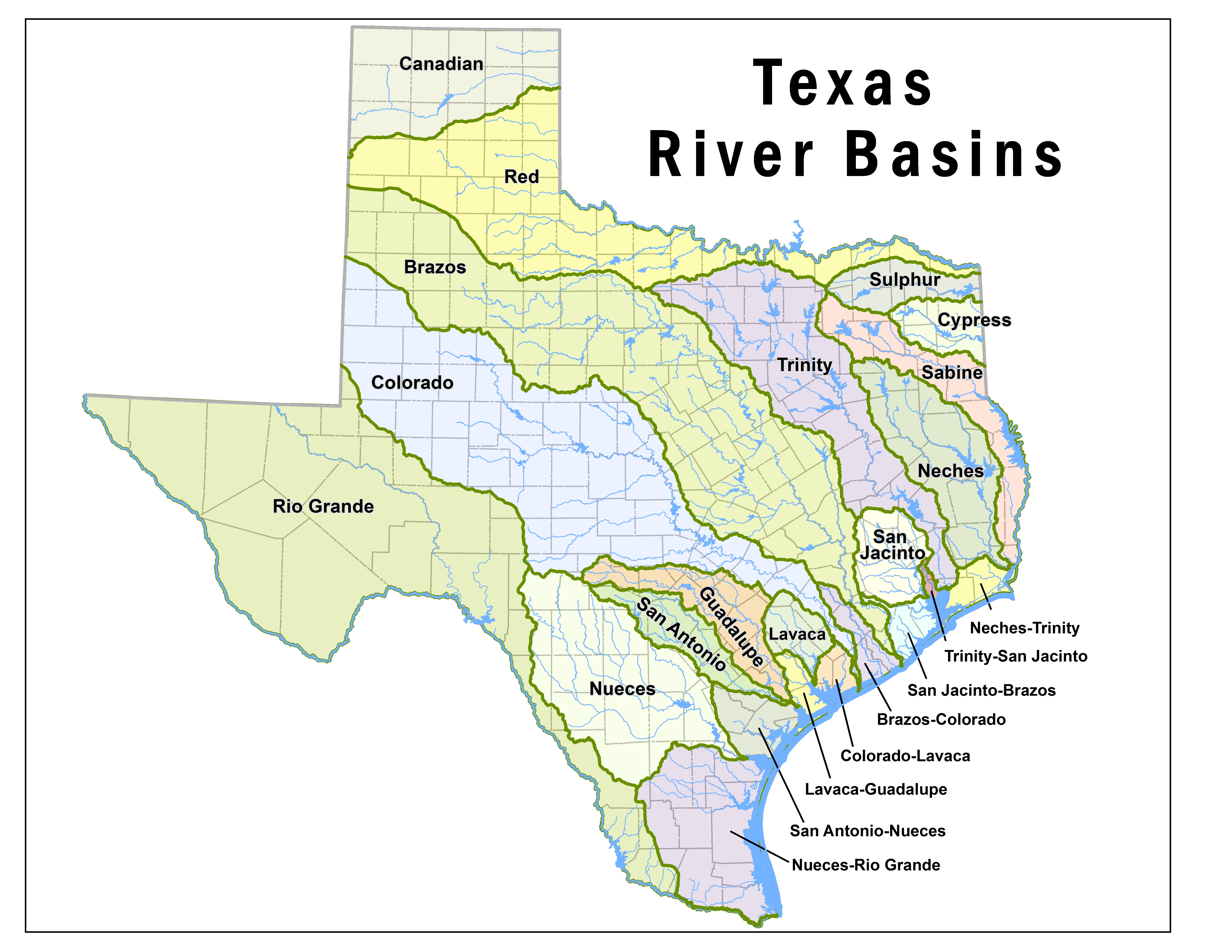
| The content of this resource is derived from | https://www.tceq.texas.gov/assets/public/comm_exec/images/basin-map.jpg |
Credits
Contributors
People or Organizations that contributed technically, materially, financially, or provided general support for the creation of the resource's content but are not considered authors.
| Name | Organization | Address | Phone | Author Identifiers |
|---|---|---|---|---|
| Gretchen R. Miller | Texas A&M University;Texas Water Observatory | Texas, US | 9796761273 | ORCID , ResearchGateID , GoogleScholarID |
| Al Nelson | Texas A&M Research Farm | |||
| Charles Stroyer | Interpex Limited |
How to Cite
This resource is shared under the Creative Commons Attribution CC BY.
http://creativecommons.org/licenses/by/4.0/
Comments
There are currently no comments
New Comment