Checking for non-preferred file/folder path names (may take a long time depending on the number of files/folders) ...
This resource contains some files/folders that have non-preferred characters in their name. Show non-conforming files/folders.
This resource contains content types with files that need to be updated to match with metadata changes. Show content type files that need updating.
| Authors: |
|
|
|---|---|---|
| Owners: |
|
This resource does not have an owner who is an active HydroShare user. Contact CUAHSI (help@cuahsi.org) for information on this resource. |
| Type: | Resource | |
| Storage: | The size of this resource is 56 bytes | |
| Created: | May 20, 2025 at 4:45 a.m. (UTC) | |
| Last updated: | Feb 04, 2026 at 9:40 p.m. (UTC) | |
| Citation: | See how to cite this resource |
| Sharing Status: | Public |
|---|---|
| Views: | 1213 |
| Downloads: | 45 |
| +1 Votes: | Be the first one to this. |
| Comments: | No comments (yet) |
Abstract
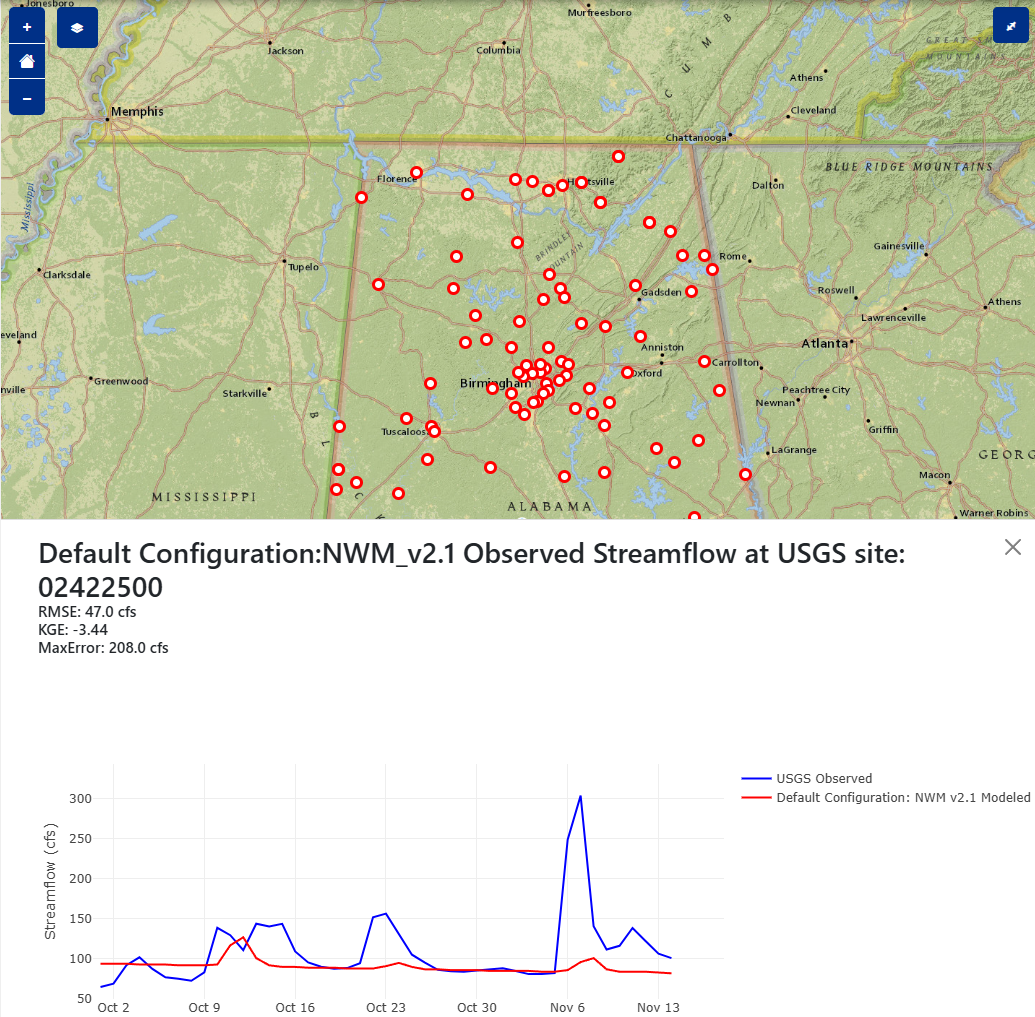
Given the launch of the Cooperative Institute for Research to Operations in Hydrology (CIROH) in April, 2020, CIROH scientists from 28 different academic, government, and private are working to improve the understanding of hydrologic processes, operational hydrologic forecasting techniques and workflows, community water modeling, translation of forecasts to actionable products, and use of water predictions in decision making. National-scale streamflow modeling remains a modern challenge, as changes in the underlying hydrology from land use and land cover (LULC) change, anthropogentic streamflow modification, and general process components (reach length, hydrogeophysical processes, precipitation, temperature, etc) greatly influence hydrological modeling. To benchmark model performance, characterize improvements in hydrological modeling formuations, and generate reproducible science, the team at the Alabama Water Institute (AWI) developed Community Streamflow Evaluation System (CSES) to originally characterize the water supply forecasting skill of the National Water Model v2.1 (NWM v3.0 coming soon!) in the Great Salt Lake Basin. The tool quickly scaled and with the support of the Earth Science Information Partners (ESIP), provided an opportunity to turn the novel evaluation platform into a web application. This GitHub repository contains the code to create an innovative Tethys Web Platform to share our research tools with the great research and operational hydrological community. By using CSES, researchers and practitioners can interact with model outputs and evaluate the performance of hydrological models (currently the NWM v2.1) for their region.
Subject Keywords
Coverage
Temporal
| Start Date: | |
|---|---|
| End Date: |
Content
Additional Metadata
How to Cite
This resource is shared under the Creative Commons Attribution CC BY.
http://creativecommons.org/licenses/by/4.0/
Comments
There are currently no comments
New Comment